How Crash Investigation Technology Is Changing Road Safety
Special FeatureTuesday, 07 July 2026 at 01:27
What if a car could tell its side of the story? A decade or two ago, that would've sounded like science fiction. Today, not so much.
Modern vehicles record nearly every twitch and swerve: how fast, how
hard, whether you braked or just held your breath. When metal clashes
and stories diverge, that digital record steps in. It’s changing more than just
insurance fights — it’s nudging street design, courtroom arguments, and the way
we all drive.
Here’s how the
game has changed — and why the impact runs far beyond the crash itself.
From Hunches to Hard Drives: The New Era of Crash Investigation
For a long time,
crash scenes were stitched together from gut feeling and whatever an officer
could grab before traffic had to move again.
A few photos.
Chalk lines. A quick sketch on the back of a report. The scale of the problem
made that approach feel thinner every year.
So the toolkit
changed.
Now investigators
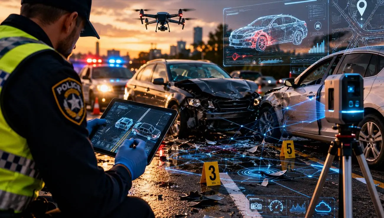
roll up with laser scanners, laptops, data cables for “black box” downloads,
and access to traffic cameras and plate readers.
Picture this
scenario.
You’re stopped at
a red light in Marietta, humming along to the radio. Suddenly, a pickup barrels
into your rear bumper. Sirens, flashing lights, someone arguing you “stopped
too suddenly.” Your own memory is scrambled — so is everyone else’s.
But now the
officer is plugging a cable into your dash, a drone buzzes overhead, and
there’s a 3D scanner spinning on the median.
The difference?
The story doesn’t just rely on who yells loudest. If the crash happened in
Marietta or the surrounding Cobb County areas, a Persons car accident lawyer can help bridge
the gap between confusing digital evidence and your side of things.
These lawyers move
fast — nailing down event data recorder (EDR) downloads, chasing traffic camera
footage before it’s erased, and pulling medical records so your injuries aren’t
ignored.
That’s the new
reality: more facts, less guesswork, and somebody who knows how to put it all
together for you.
How Crash Investigation Technology Is Making Roads Safer
The interesting
part is what happens after the reports are filed. Piece by piece, these tools
turn isolated crashes into clues about how to make the whole network less
deadly.
Here’s how:
Vehicle Data Recorders Reveal the Missing Seconds
Event Data
Recorders (EDRs) ride quietly in most newer vehicles.
In the seconds
around a crash, they log:
●
Speed
●
Brake and throttle use
●
Seat belt status
●
Change in speed on impact
NHTSA research shows EDRs are installed in the
majority of late‑model cars and play a regular role in serious crash
investigations.
Those tiny windows
of data answer the arguments that used to drag on: who was actually speeding,
whether anyone tried to stop, how severe the hit really was.
3D Mapping Creates More Accurate Reconstructions
Laser scanners and
photogrammetry rigs have quietly replaced a lot of tape measures.
Teams sweep the
scene, then software turns millions of points into a 3D model — vehicle
positions, skid marks, barriers, even subtle dips in the pavement.
The Federal Highway Administration has linked
these “quick clearance” and advanced documentation methods with shorter
incident times and fewer secondary crashes near scenes.
Later, that same
model helps answer tougher questions: did a guardrail fail, did a curve hide
oncoming traffic, was a crosswalk visible at night or effectively invisible
until the last second?
Video Footage Helps Identify Dangerous Patterns
Traffic cameras
and nearby security systems used to be background noise. Now they’re core
witnesses. A single clip can settle who jumped the light.
Months of video
show deeper patterns — risky left‑turn phases, crosswalks drivers keep
ignoring, merge lanes that trigger constant close calls.
Cities chasing
“Vision Zero” targets lean heavily on this mix of crash and camera data. New
York City, for example, has reported fewer traffic deaths than in pre‑Vision
Zero years after using that information to redesign corridors and adjust
enforcement.
Drones Speed Up Scene Documentation
Drones give
investigators something they never had before: a safe, fast overhead view.
They fly over
pileups or complex intersections, capturing overlapping images that mapping
software turns into accurate aerial diagrams. Lanes reopen faster, which cuts
the risk of secondary crashes in the backup.
The Road Ahead Looks Different
The daily commute
still feels like traffic lights, radio static, and the drone of tires.
But beneath it,
every crash feeds a richer digital memory.
That’s what roads
— and the justice that follows them — are starting to run on. And every new
layer of truth gets us closer to a safer, clearer ride home.


Latest News




Loading